When it comes to construction or land development projects, geomatics will be critical in the preparation stage. Whether you plan to build property, manage pipelines, or construct roads and highways, you should first gather relevant data to plan and create your project design. Fortunately, there are plenty of geomatic services to help you get all the information you need to get started.
Regardless of what project you have in mind, you should assess the land thoroughly to determine how you can best use it. To give you a better idea of how geomatics can help you, here are some of the most common services used in different types of projects below.
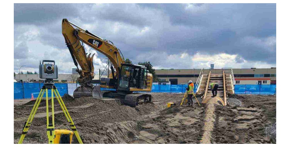
Construction Survey
A construction survey shows the locations and markers for construction activities to assess the main topographic features on the land. Generally, surveying involves providing layout stakes to position structures and mapping out the project area.
Construction surveys are one of the most beneficial geomatic services since you can use them for all types of construction projects—big or small. So whether you have some home improvements planned out or want to build a multi-unit subdivision, you can use this survey as a guide to mark the suitable areas for your structures.
Topological Survey
Topographic surveys are beneficial in the first phase of any building or development project. They provide data on a parcel of land’s natural and manufactured features, contour lines, and property lines to show how it is laid out. Overall, this survey gives you a multi-dimensional view of your land or property, which will help you design your project.
Pipeline Survey
Pipeline surveying involves analyzing water distribution pipelines and sewer water collection in a particular area. This type of survey will help you assess the condition of a pipeline and determine whether it needs to be repaired or replaced.
Pipeline inspections can help prevent pipeline failures by exposing cracks, weak points, and deterioration before they occur. Aside from this, trenchless technology has made it possible to monitor the state of your installed pipelines without having to dig. Thus, you can save a significant amount of time, effort, and money in managing your pipes.
Geographic Information Systems (GIS)
With Geographic Information Systems (GIS), you can capture, manage, analyze, and display all types of geographic data. This technology allows you to visualize and map out your land and investigate its suitability for different projects to help you make better decisions.
Generally, one of the most significant variables in GIS is location. GIS tools enable you to capture individual areas using a site’s latitude, longitude, and elevation. They can also create representations of the actual environment for project planning, so you can test out different layouts and find the most suitable one.
Unmanned Aerial Vehicles (UAVs)
Nowadays, unmanned aerial vehicles (UAVs) have become a staple in construction management. They allow you to conduct aerial surveys, real-time inspections, worksite surveillance, and job site safety monitoring to stay on top of your project’s progress.
With UAVs’ high-resolution cameras and high-quality sensors, you may build a surveying system to collect timely, accurate, and reliable aerial data. After that, you can assess and analyze the data you collected using specialist tools to change your project plans.
Overall, geomatics is a valuable discipline that provides relevant geographical information to aid in your project preparation. For infrastructure and development projects, accurate and relevant data provide the foundation for decision-making and compliance with quality standards. Thus, Geomatic services can promptly deliver the mapping you require, allowing you to keep your project on track.