When buying, selling, or developing land, getting a proper property survey is one of the smartest steps you can take to avoid costly surprises. Accurate surveying ensures that property boundaries, easements, and land features are clearly defined — saving you from potential disputes and legal issues down the road. If you’re considering land survey services in Edmonton, it helps to know exactly what to expect at each stage of the process.
Here’s a complete breakdown of what happens before, during, and after a property survey:
Before the Survey: Preparing for Accuracy
Preparation plays a key role in ensuring your survey goes smoothly. Before a surveyor even sets foot on your property, here are a few things you should do:
- Define Your Purpose. Are you buying, selling, subdividing, or starting a construction project? Different projects require different survey types, such as boundary surveys, topographic surveys, or real property reports. Knowing your objective will help your surveyor plan effectively.
- Gather Important Documents. Collect any available property records, previous surveys, and legal descriptions from your title deed. Providing these documents to your surveyor helps ensure accuracy and prevents inconsistencies.
- Communicate with Your Neighbours. While not always required, it’s a good idea to inform adjacent property owners, especially if boundary markers may be near shared fences or driveways. Open communication can prevent disputes later on.
- Choose a Qualified Professional. Accurate results depend on hiring experts who specialize in land survey services in Edmonton. A certified surveyor will use the latest technology and comply with local regulations to ensure your results are reliable and legally valid.
During the Survey: What Actually Happens
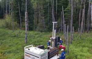
Once your survey is scheduled, a team of professionals will visit your property to collect precise measurements and data. Here’s what typically happens:
- Boundary Marking. Using advanced equipment like GPS, robotic total stations, and laser scanners, surveyors identify and mark property boundaries based on historical records and on-site measurements.
- Feature Mapping. If you’re planning construction or landscaping, surveyors also map out topography, elevations, and existing features such as trees, fences, and utilities. This ensures you have a clear understanding of your land’s layout.
- Resolving Discrepancies. Sometimes, survey results may not match existing property lines, especially in older neighborhoods. In such cases, your surveyor will analyze deeds, previous records, and field data to resolve inconsistencies and provide you with the most accurate information possible.
- Data Verification. Before finalizing the results, surveyors perform multiple checks to ensure every measurement is precise. The accuracy of your survey is critical, especially when it comes to avoiding costly boundary disputes.
After the Survey: Understanding the Results
Once the fieldwork is complete, your surveyor will prepare a detailed report and map outlining all findings. Here’s what to expect next:
- Reviewing the Report. The survey document will include a visual map showing property lines, easements, right-of-ways, and other relevant information. It’s important to review these details carefully, especially if you’re buying or developing land.
- Planning Future Projects. For those planning construction, fencing, or landscaping, your survey results will guide design decisions and ensure you’re working within your legal property boundaries. This can save you significant costs and headaches later on.
Property surveys are an investment in peace of mind. Whether you’re a first-time homebuyer, a seasoned developer, or a landowner planning improvements, hiring professionals who specialize in land survey services in Edmonton ensures accuracy, legal compliance, and long-term protection for your property.
For More Information About Land Survey Companies Saskatchewan and Land Survey Regina Please Visit: CORE Geomatics.